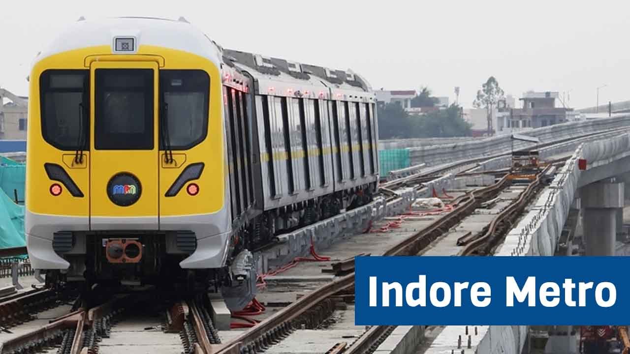
Indore, one of the fastest-growing cities in India, is on the verge of a significant transformation with the introduction of the Indore Metro. This ambitious project aims to revamp the public transport system, providing a modern, efficient, and eco-friendly solution to the current traffic situation. But what is Indore Metro, and what does it consist of? Let’s discuss this in detail.
Table of Contents
Indore Metro Overview
- Length:
- Planned: 33.53 km
- Under Construction: 16.21 km
- Approved: 17.32 km
- Stations:
- Planned: 29
- Under Construction: 16
- Approved: 13
- Lines: 1 – Yellow Line
- Track gauge: 1,435 mm (4 ft 8+1⁄2 in) standard gauge
- Speed: 90 km/h
- Type: Elevated & Underground
- Cost: ₹7500.80 crore
- Completion Time: 2025 (Priority Corridor), 2027 (Phase-1)
About Indore Metro
The Indore Metro is a rapid transit system being built in the city of Indore in the Indian state of Madhya Pradesh. The system has a total of eleven corridors (lines), spanning 124 kilometres (77 mi). The project will cost around Rs 12,000 crore, i.e., about US$1.4 billion. The total cost will be Rs 15,000 crore, with Rs 182 crore being spent per kilometer. The metro system will be both underground and elevated. The Indore Metro project has generated a lot of controversy due to the erroneous shifting of the seismic zone-II to the seismic zone-IV category, which is the reason for the increased cost for the entire project.
The Indore Metro project aims to create a world-class urban transport system to meet the goals of development and modernization of the city. It also aims to reduce traffic congestion, reduce pollution, and improve the overall quality of life of people in Indore, as well as provide a reliable, efficient, and sustainable transport system.
The key features of the Indore Metro include state-of-the-art trains, an advanced signaling system, and passenger-friendly features designed to give passengers a comfortable and safe travel experience.
Historical Background
Rohit Associates Cities & Rails Pvt Ltd has prepared the master plan for the Indore Metro, which is 94 km long. It envisages four metro lines and two spurs, of which one (Yellow Line/Line-3 – a ring line) has been decided to be launched in Phase 1.
In December 2016, the state government approved the detailed project report (DPR) of the Indore Metro Phase 1 project, covering 33.53 km of route, and in October 2018, the Union Cabinet approved it.
The state’s chief minister laid the foundation stone for the first phase of the project in September 2019. The construction work, which began in 2019, is expected to be completed in 2027.
Indore Metro Route
The Indore Metro route project will cost around Rs 12,000 crore. Of the total Rs 15,000 crore, the expenditure will be Rs 182 crore per kilometre.
The central government cabinet has approved the construction of Phase-I, Line 3 of the Indore Metro route, 33.53 kilometres long, with a detailed project report (DPR) prepared in 2018. The construction of the metro route began in 2019 and should be completed by 2026.
The Indore Metro route consists of a network of 100-107 km, with overlapping and branching lines. The final metro route is divided into four lines, one of which is currently being built. The government and institutions have presented additional examples.
Yellow Line
- Length: 33.53 km
- Stations: 29
Indore Metro Route Map

Indore Metro Stations
Yellow Line
- Bhawarsala Square
- MR 10 Road
- ISBT / MR 10 Flyover
- Chandragupta Square
- Hira Nagar
- Bapat Square
- Meghdoot Garden
- Vijay Nagar Square
- Radisson Square
- Mumtaj Bag Colony 1
- Mumtaj Bag Colony 2
- Bengali Square
- Patrakar Colony
- Palasia Square
- High Court / Hotel Residency
- Indore Railway Station
- Rajwada Palace
- Maulana Azad Marg
- Bada Ganpati
- Ramchandra Nagar Square
- Kalani Nagar/BSF
- Airport
- Gandhi Nagar Nanod
- Super Corridor 6
- Super Corridor 5
- Super Corridor 4
- Super Corridor 3
- Super Corridor 2
- Super Corridor 1
Indore Metro Progress
Construction of the Indore Metro is moving at a steady pace, with much of the work already completed. The project was initially delayed due to a number of challenges, including land acquisition and environmental clearance, but has since gained momentum. The first phase is expected to begin by 2026.
16.217 km route is under construction between Gandhi Nagar – Mumtaj Bag Colony
Indore Metro Proposed Lines
Line-1A: Sri Aurobindo Hospital – Collectorate office – Indore Bypass 1
- Number of Stations: 18
- Station Names: Sri Aurobindo Hospital, Bhawarsala Square, Sanwer Industrial Area, Ganesh Sham Colony, Banganga, Laxmibai Nagar Square, Mara Mata Square, Imli Bazar Chowk, Rajwada Palace, Collectorate Office, Indore Icchapur Rail Crossing, Tower Square, Bhawarkuan Square, Holkar University/IT Park, Rani Bagh, Limbodi, Ralamandal, Indore Bypass 1
Line-1B: Sri Aurobindo Hospital – Collectorate office – Regional Park (1B)
- Number of Stations: 13
- Station Names: Sri Aurobindo Hospital, Bhawarsala Square, Sanwer Industrial Area, Ganesh Sham Colony, Banganga, Laxmibai Nagar Square, Mara Mata Square, Imli Bazar Chowk, Rajwada Palace, Collectorate Office, Central Excise, Choithram, Regional Park
Line-2: Dewas Naka – Juni Indore – MHOW
- Number of Stations: 28
- Station Names: Dewas Naka, Niranjanpur Circle, Aranya Nagar, IDA Park, Vijay Nagar Square, Bhamori, Patni Pura/St Joseph Church, Malwa Mill Square, Raj Kumar Bridge, Indore Railway Station, Juni Indore, Collectorate Office, Mhow Naka, Dusshera Maidan, Annapurna Temple, Narmada Public School (Ring Road), Rajendra Nagar, Reti Mandi, IPS Academy, Shramik Colony, Indore Bypass-2, Pigdambar, Umariya, Maa Vaishno Devi Hospital, Haranya Kheri / IIT Indore, Chinar Residency, MHOW
Line-4: MR9 – Indore Railway Station – Indore Bypass 4
- Number of Stations: 16
- Station Names: MR9, Convention Center, Lahiya Colony, Chandragupta Square, Sukhliya, Nanda Nagar Main Road, Mazdoor Maidan, Rajkumar Bridge, Indore Railway Station, Chhavani, Sri Agrasen Maharaj Chowk, Navlakha Bus Station, Teen Imli, Babul Nagar, Musakhedi, Indore Bypass 4
Conclusion
Indore Metro is going to be a game-changer, providing the city with modern, efficient, and sustainable modes of transportation. The project aims to transform the urban landscape of Indore and make it a more connected and accessible city. Indore Metro will pave the way to a brighter and more sustainable future with continued support and collaboration.
FAQs
1. How many lines will the Indore Metro have?
The Indore Metro will initially have a single main line, and plans for future expansions with 4 new lines.
2. What is the expected completion date for Indore Metro?
The first phase of the Indore Metro is expected to be operational by 2027.