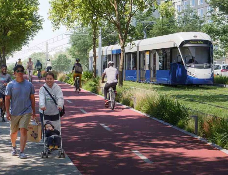
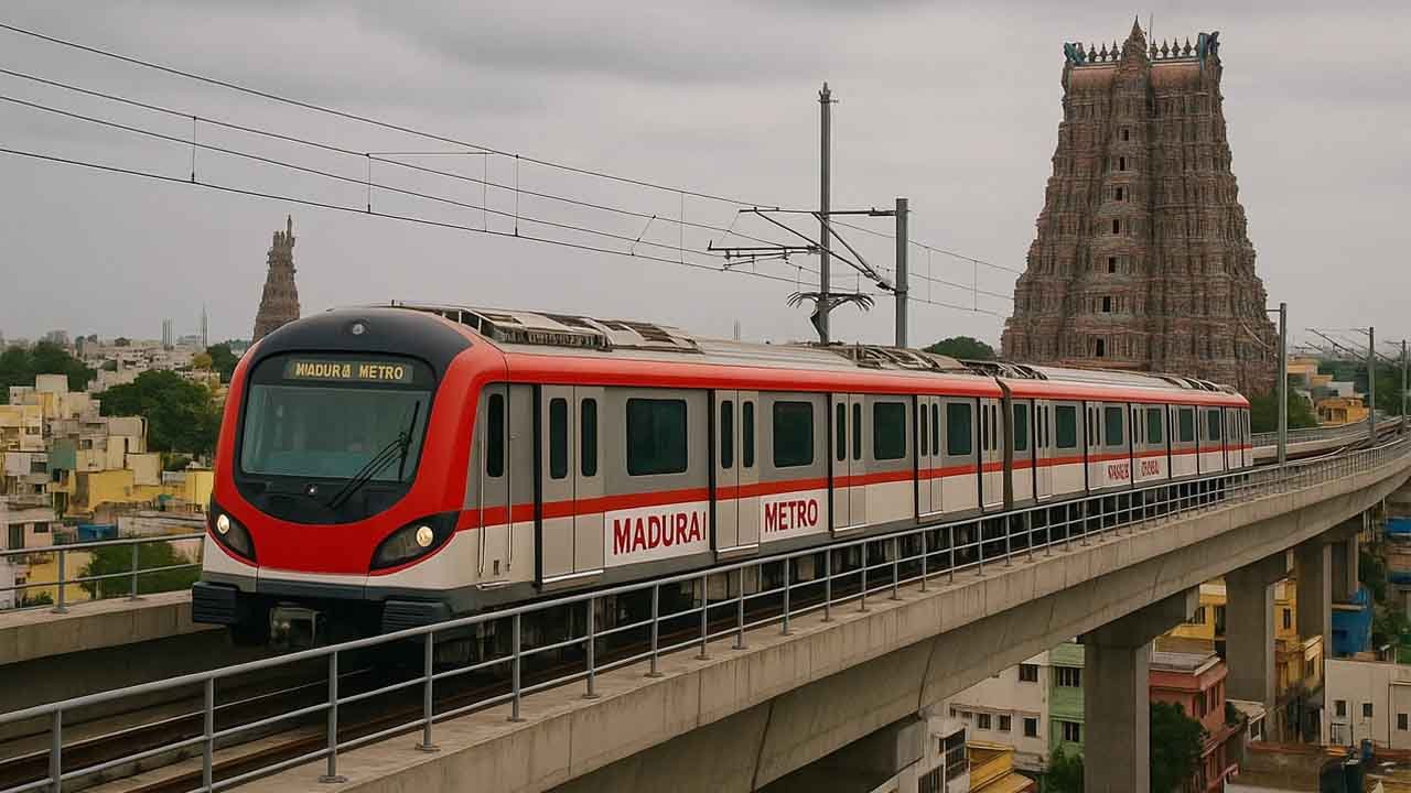
Madurai Metro Rail is poised to become a transformative public transportation solution in Tamil Nadu, ushering in a new era of sustainable urban mobility. Envisioned as part of the Tamil Nadu Vision 2023 plan, the Madurai Metro aims to reduce congestion, improve connectivity, and catalyze regional economic development. With a blueprint that aligns with the modern standards of metro infrastructure, this project integrates advanced engineering, smart mobility systems, and inclusive urban planning to serve the needs of Madurai’s growing population.
Table of Contents
- 1 Madurai Metro Overview
- 2 Madurai Metro Corridor Plan – Phase 1 Route Map and Key Stations
- 3 Madurai Metro Route Map
- 4 Technical Specifications – Infrastructure and Rolling Stock
- 5 Development Timeline and Funding
- 6 Economic and Social Impact
- 7 Integration with Regional Transport
- 8 Challenges and Mitigation Strategies
- 9 Future Expansion – Phase II and III
- 10 Conclusion
Madurai Metro Overview
- Length: 31 km (Line 1), 20 km (Line 2), 23 km (Line 3)
- Stations: 22 (Line 1), 14 (Line 2), 19 (Line 3)
- Lines: Line-1 (Phase-1), Line-2,3 (Phase-2)
- Track gauge: 1,435 mm (4 ft 8+1⁄2 in) standard gauge
- Speed: 60 km/h
- Type: Elevated & Underground
- Cost: ₹9000 crore
- Completion Time: December 2027
The Madurai Metro is more than a mass transit project—it’s a blueprint for future-ready infrastructure development in southern India. It targets several strategic outcomes:
- Alleviate Urban Congestion: Reduce dependency on road transport by providing an efficient alternative.
- Promote Sustainable Development: Reduce carbon emissions through electrified rapid transit.
- Boost Economic Activity: Enhance intra-city and inter-city mobility, supporting commerce and tourism.
- Urban Inclusivity: Ensure accessible transport for all demographics, including elderly and differently-abled citizens.
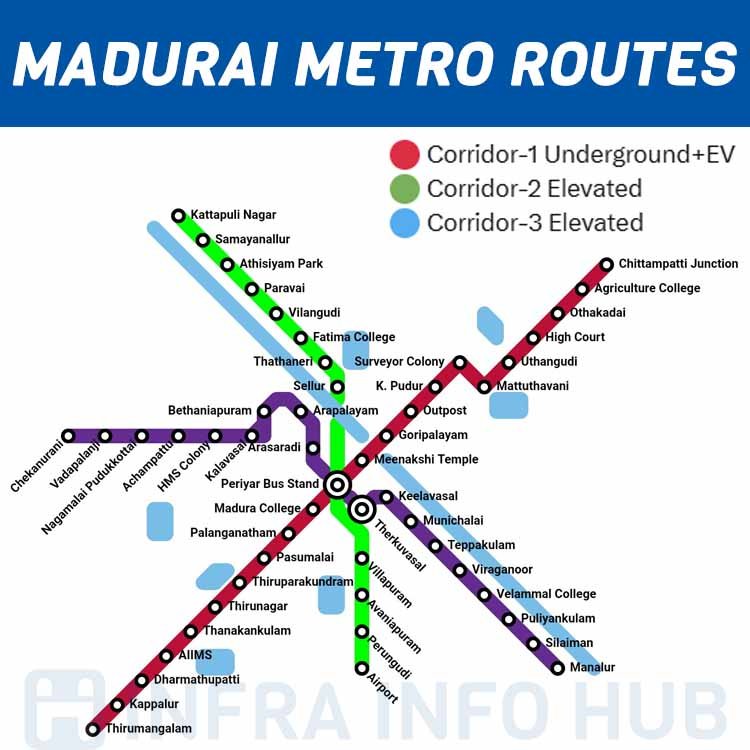
Madurai Metro Corridor Plan – Phase 1 Route Map and Key Stations
The Phase I of Madurai Metro Rail spans 31 kilometers, connecting vital nodes across the city in a single elevated corridor:
Madurai Metro Station List (Line 1 – Tirumangalam to Othakadai):
- Thirumangalam
- Kappalur Toll Plaza
- Dharmathupatti
- Thoppur
- Thirunagar
- Thirupparankundram
- Pasumalai
- Vasantha Nagar
- Madurai College
- Madurai Junction Railway Station
- Simmakkal
- Keelavasal
- Therkuvasal
- Goripalayam
- Police Commissioner’s Office
- K Pudur
- Mattuthavani
- Uthangudi
- High Court
- Othakadai
- Agriculture College
- Chittampatti Junction
Expected Travel Time:
Approximately 35 minutes end-to-end, designed for peak-hour efficiency.
Madurai Metro Route Map
Technical Specifications – Infrastructure and Rolling Stock
- Track Length: 31 km (Elevated)
- Gauge: Standard gauge – 1435 mm
- Electrification: 750V DC third rail system
- Train Frequency: 5-7 minutes during peak hours
- Car Configuration: 3-6 coach trains with regenerative braking and real-time diagnostics
- Maximum Speed: 80 km/h
- Signaling System: CBTC (Communication Based Train Control) for automated operation
Development Timeline and Funding
| Milestone | Date / Status |
|---|---|
| DPR Submission to CMRL | Completed (by SYSTRA Group) |
| Tamil Nadu Cabinet Approval | Approved |
| Detailed Design Phase | Ongoing |
| Tendering and Contractor Selection | Scheduled 2025 |
| Construction Start | Expected Q4 2025 |
| Phase I Completion | Targeted for 2029 |
The project is backed by the Tamil Nadu Government and international funding bodies such as the Asian Development Bank (ADB) and Japan International Cooperation Agency (JICA). The estimated cost for Phase I is ₹9,000 crore.
Economic and Social Impact
The Madurai Metro is expected to deliver multi-dimensional benefits to the region:
Economic Boost
- Increased job opportunities during and post-construction
- Enhanced logistics for goods and services
- Real estate appreciation along metro corridors
Environmental Benefits
- Reduction of vehicular emissions by over 20,000 tonnes annually
- Integration with non-motorized transport zones
- Noise pollution minimization via insulated track technologies
Urban Development Catalysis
- Transit-Oriented Development (TOD) to stimulate organized urban expansion
- Interlinking with bus terminals and railway stations for multimodal connectivity
- Pedestrian-friendly infrastructure development in station zones
Integration with Regional Transport
The Madurai Metro will be fully integrated with existing and upcoming modes of transport:
- Mofussil Bus Terminals: Link with Periyar and Mattuthavani terminals
- Indian Railways: Easy interchange at Madurai Junction
- Smart Ticketing: Unified travel cards and QR-code based e-ticketing
Challenges and Mitigation Strategies
Challenges:
- Dense urban fabric complicating land acquisition
- Potential impact on historical and religious landmarks
- Resistance from legacy transport providers
Solutions:
- Pre-emptive resettlement planning with compensation
- Environment and heritage impact assessment compliance
- Public consultation and PPP models to involve stakeholders
Future Expansion – Phase II and III
Plans are underway to extend the metro network with Phase II, which is expected to add an additional 40 kilometers, connecting Madurai Airport, the IT corridor near Vadapalanji, and major suburban belts. This expansion aligns with the state’s Smart Cities Mission and aims to integrate feeder bus networks and last-mile e-mobility solutions.
Conclusion
The Madurai Metro is not just a transport initiative but a hallmark of infrastructural modernization. By connecting people, economies, and opportunities, the project exemplifies the state’s commitment to inclusive, green, and technologically advanced urban growth. With strategic planning, robust funding, and stakeholder participation, the Madurai Metro Rail project is set to redefine mobility standards in southern India.