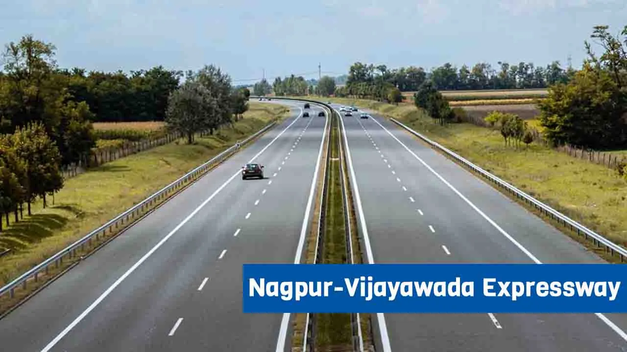
Tag: Expressway

  • Ganga Expressway: Route, Map, Cost, Progress and Latest Updates

    Ganga Expressway: Route, Map, Cost, Progress and Latest Updates

    The Ganga Expressway is a big new road project in Uttar Pradesh. In the first phase, it will link Judapur Dandu village in Prayagraj with Bijauli village in Meerut. The government plans to complete the project by December 2025.

    Ganga Expressway Overview

    • Total Length: 594 Kilometers
    • Lanes: 6 (expandable to 8)
    • Cost: ₹36,000 crores
    • Starting Point: Bijauli village, Meerut district
    • Ending Point: Judapur Dandu village, Prayagraj district
    • Completion time: December 2025

    About Ganga Expressway

    The Ganga Expressway is a new green field expressway project started by the Uttar Pradesh state government. It will have six lanes, with a plan to expand to eight lanes if needed. The length of the expressway will be 594 kilometers.

    This expressway will begin in Meerut and end in Prayagraj, passing through 12 districts. The project is expected to cost around ₹36,000 crore.

    Once finished, it will reduce travel time between Meerut and Prayagraj to about eight hours. Vehicles on this expressway will be allowed to run at speeds up to 120 km/h, so the journey might take even less time in good conditions.

    The Ganga Expressway will help improve travel, boost trade, and connect many parts of Uttar Pradesh more quickly and easily.

    Ganga Expressway Route

    Ganga Expressway Route

    Covered Districts : 

    1. Meerut
    2. Amroha
    3. Bulandshahar
    4. Badaun
    5. Shahjahanpur
    6. Farrukhabad
    7. Hardoi
    8. Kannauj
    9. Unnao
    10. Rae Bareli
    11. Pratapgarh
    12. Prayagraj

    The Ganga Expressway will pass through 12 districts of Uttar Pradesh. It is an important project because it will link the western and eastern parts of the state, helping the entire stretch grow in terms of business and infrastructure.

    This expressway will also connect villages near the Ganga River, giving them better access to roads and transport. Many of these rural areas currently don’t have good road connections. The expressway will improve travel and make it easier to move goods and services in these places.

    While it will mainly connect East and West Uttar Pradesh, it will also support the growth of new expressways in the state and help boost industries, jobs, and local economies in nearby areas.

    Ganga Expressway Progress

    The Ganga Expressway from Meerut to Prayagraj is being built in 12 parts to speed up the work. This 594 km long road will have 8 road over bridges, 8 flyovers, and 12 toll plaza ramps. A flyover is already being built near Ataula village on the Hapur–Kithore Road.

    So far, 94% of the land needed for the project has been taken over. A new bridge in Garhmukteshwar will help people from nearby areas like Hapur and Bulandshahr use the expressway more easily.

    Between Janpad and Hapur, about 40% of the work on underpasses and overpasses has been completed. A flyover is also under construction near Ataula village.

    More than 25 km of main road have already been built. The Uttar Pradesh government is working hard to finish the expressway by December next year, before the Kumbh Mela 2025. The company building it has been told to speed up the work.

    A 12-lane bridge is also being built across the Ganga River, from Shankar Tila village in Hapur to Piplauti village on the other side. This bridge will be 960 meters long and will have 16 pillars, spaced about 60 meters apart.

    Work on the middle pillar is slow because of high water levels in the Ganga, but the outer pillars are being built quickly.

    Ganga Expressway Specifications

    • A 3.5 km airstrip will be built on the Ganga Expressway in Shahjahanpur so that Air Force planes can land and take off during emergencies.
    • The main toll plazas will be set up in Meerut and Prayagraj, along with 12 extra ramp toll plazas to help manage traffic.
    • There will be 8 road over bridges and 8 flyovers on the expressway to make travel smoother.
    • New industrial areas will be planned at key spots along the expressway to boost business and job opportunities.
    • The Ganga Expressway will connect to the Yamuna Expressway and the Agra–Lucknow Expressway, making travel easier between Delhi and eastern Uttar Pradesh.
    • The road will reduce travel time between Meerut and Prayagraj from over 11 hours to around 8 hours. This will help improve business, trade, and overall development in the region.

    Conclusion

    The Ganga Expressway will help improve industry, trade, farming, tourism, and other areas. It will also boost the social and economic growth of the region.

    When completed, it will be the longest expressway in Uttar Pradesh, connecting the eastern and western parts of the state and making travel easier.

  • Atal Progress Way (Chambal Expressway) – Route, Map, Cost, Progress, and Latest Update

    Atal Progress Way (Chambal Expressway) – Route, Map, Cost, Progress, and Latest Update

    Atal Progress Way, or Chambal Expressway, or Atal Pragati Path, will connect Rajasthan, Madhya Pradesh, and Uttar Pradesh. Starting from Kota in Rajasthan, it will end at Etawah in Uttar Pradesh via the Sheopur and Morena districts of Madhya Pradesh. 

    To improve road transport in the country, work is being done rapidly on various road projects, including expressways. In this development, Atal Progress Way is being built in Madhya Pradesh. In particular, the connectivity of the three states of Uttar Pradesh, Madhya Pradesh, and Rajasthan will be improved through this Atal Progress Way. 

    This expressway was named the Chambal Expressway when it started. But, to honor former Prime Minister Atal Bihari Vajpayee, the Madhya Pradesh government changed its name to Atal Progress Way.

    Atal Progress Way Overview

    • Length: 408  km
    • Cost: ₹ 23,645 crore
    • Lanes: 4 (Expandable to 6)
    • Starting Point: Seemalya, Kota district, Rajasthan
    • Ending Point: Nanawa, Etawah district, Uttar Pradesh
    • Completion Year: 2027

    About Atal Progress Way

    Atal Progress Way is an ambitious project of the Madhya Pradesh government. This four-lane expressway will connect Uttar Pradesh, Rajasthan, and Madhya Pradesh. This expressway will be built by the National Highway Authority of India. NHAI has started the process of DPR and land acquisition for this. Let us know the path of Atal Progress Way and its features.

    The proposed “Atal Progress Way” will be built on the banks of the Chambal River. It will connect the famous city of Kota in Rajasthan and Etawah in Uttar Pradesh to Madhya Pradesh. The length of this expressway will be 408 kilometers, of which 309 kilometers will be in Madhya Pradesh, 17 kilometers in Rajasthan, and 78 kilometers in Uttar Pradesh. The estimated cost of this project is ₹ 23,645 crore.

    Alt Progress-Way will start from Etawah in Uttar Pradesh, pass through Bhind and Morena in Madhya Pradesh, and reach Rajasthan from Khatauli in Kota district. The construction of this expressway will change the situation of the Bhind, Morena, and Sheopur districts of Madhya Pradesh, as well as the surrounding areas. Logistics parks, industrial centers, agricultural production centers, food processing centers, smart cities, resorts, education centers, and other facilities will be built on both sides of the expressway.

    This will provide new job opportunities in these areas. More than 200 villages in the three states will get huge benefits from this project. Atal Progress-Way will be built first four lanes. When this expressway increases traffic, it can be six lanes in the future.

    Atal Progress Way Route

    Atal Progress Way Route

    The expressway will run alongside the Chambal River. It will pass through the following states and their subordinate territories:

    Rajasthan

    The expressway will start at Seemlya village in the Kota district and will have an interchange with the Delhi-Mumbai expressway. The expressway will cover a distance of 72 km in Rajasthan.

    Madhya Pradesh

    It will cover 313 km in Madhya Pradesh. An interchange will be built in Morena to connect the Agra-Gwalior Expressway.

    In Madhya Pradesh, it will pass through Sheopur in Sheopur district, Sabalgarh in Morena district, Morena in Morena district, and Bhind in Bhind district.

    Uttar Pradesh

    The eastern end of the expressway will be at Nanawa village in Etawah district, from where a spur will be built to connect the expressway to the Agra-Lucknow expressway. It will cover 23 km in Uttar Pradesh.

    Atal Progress Way Progress

    According to recent news, the National Green Tribunal (NGT) has not permitted the National Highway Authority of India (NHAI) to build the Atal Progress Way. The route has been changed to prevent the Chambal Valley from becoming an eco-sensitive area. Now the expressway will pass through ten rivers, not eight. By changing the route, land acquisition will take more time because earlier, about 75% of the land was with the government, but now about 90% of the land is with private agriculture.

    In June 2022, the National Highways Authority of India (NHAI) applied for environmental clearance. The project will pass through a small part of the Kuno National Park, and land acquisition has also started.

    NHAI floated the tender for the construction of the project in December 2022. 16 companies bid for the first two packages of the project in March 2023.

    Atal Progress Way Benefits

    1. Atal Progress Way will be a fully equipped four-lane expressway, which can be expanded to six lanes. Considering the traffic density, the authority has planned to expand the expressway.
    2. The Atal Progress Way project will have an advanced traffic management system. It will also have emergency calling booths, CCTV cameras, and fuel stations. There will also be food shops, medical care centers, and toilets on the expressway.
    3. Commuters get an average speed of 120 km/h on the Atal Progress Way. There will be speed cameras on the expressway, which will monitor the speed of vehicles.
    4. Atal Pragati Path will be connected to many major highways and expressways, making many cities more connected to each other. The expressway will also provide an option to travel from Kota to Kanpur via Madhya Pradesh, which will reduce travel time between different cities.
    5. Atal Progress Way will help in industrial development in the Chambal district of Madhya Pradesh. Logistics parks will be built in this area, which will provide immense opportunities for work in the surrounding districts and areas.

    Conclusion

    The Chambal River inspired the construction of the four-lane Atal Progress Way. Atal Progress Way (Atal Pragati Path) will be developed under Phase I of the Bharatmala Project. Along with all other benefits, Atal Pragati Path will give farmers in Chambal easy access to big markets where they can sell their crops and earn profits, and more benefits. Farmers of Chambal will get better transportation options when the expressway becomes available to the public. Good connectivity will boost economic and social development, attracting industries to build their plants near the expressway.

    Recommended:

  • Maharashtra Cabinet Approves Rs 20,787 Cr Shaktipeeth Expressway, Nagpur-Goa Travel Time to Cut by 10 Hours

    Maharashtra Cabinet Approves Rs 20,787 Cr Shaktipeeth Expressway, Nagpur-Goa Travel Time to Cut by 10 Hours

    In a major move, the Maharashtra state cabinet, led by Chief Minister Devendra Fadnavis, approved the Maharashtra Shaktipeeth Highway project on 24 June.

    This massive project, costing ₹20,787 crore, will create a fast and long road—802.6 kilometers in length—connecting Pawanar in Wardha district to Patra Devi near the Maharashtra-Goa border in Sindhudurg. The highway will pass through 12 districts, helping to improve travel, tourism, and development in rural areas.

    The government described the project as a way to connect the sacred Shakti Peethas (important Hindu temples) across the state. The plan is not just about building a road, but also about boosting spiritual tourism and supporting the economy in small towns and villages.

    Once the road is finished, travel time from Nagpur to Goa will drop from 18 hours to just 8 hours, making journeys much faster and easier.

    The expressway will pass through key districts like Wardha, Yavatmal, Hingoli, Nanded, Parbhani, Beed, Latur, Dharashiv, Solapur, Sangli, Kolhapur, and Sindhudurg. It will also connect many holy places such as Mahur, Tuljapur, Kolhapur, and Ambejogai, as well as famous pilgrimage centers like Aundha Nagnath, Parli Vaijnath, and Pandharpur. Devotees of the Datta tradition will also benefit, with towns like Karanja-Lad, Akkalkot, Ganagapur, Narsobachi Wadi, and Audumbar being linked.

    A big part of the budget—₹12,000 crore—will come from a loan by HUDCO, which will be used to buy around 7,500 hectares of land needed for the project.

    The Maharashtra Road Development Corporation (MRDC) will handle the building of the highway. Later on, this highway will connect to the Konkan Expressway, improving road access along the coastal areas of the state.

    In short, the Maharashtra Shaktipeeth Highway is not just a road—it’s a path that brings together faith, faster transport, and economic growth across the state.

  • KMP Expressway or Western Peripheral Expressway – Route, Map, Toll Charges and Latest Updates

    KMP Expressway or Western Peripheral Expressway – Route, Map, Toll Charges and Latest Updates

    The Kundli-Manesar-Palwal (KMP) Expressway, also called the Western Peripheral Expressway, is a major expressway project in India. It is 135.6 kilometers long and was opened by Prime Minister Narendra Modi in November 2018. Since then, it has helped real estate grow in both Haryana and New Delhi.

    The expressway goes around the western side of the National Capital Region (NCR) and passes through places like Sonipat, Kharkhoda, Bahadurgarh, Badli, Jhajjar, Manesar, Nuh, Sohna, Hathin, and Palwal. It helps reduce traffic in Delhi by giving trucks and long-distance vehicles a different route, making travel faster and smoother.

    This article gives a simple overview of the KMP Expressway, its route, and distance, useful for both travelers and people interested in property along the way.

    KMP Expressway Overview

    • Length: 135.6 km
    • Lanes: 6
    • Cost: ₹9,000 crore
    • Starting Point: Kundli, Sonipat
    • Ending Point: Dholagarh, Palwal
    • Completion Date: 19 November 2018

    About KMP Expressway

    The full name of the KMP Expressway is the Kundli–Manesar–Palwal Expressway. It is also called the Western Peripheral Expressway. This expressway helps move traffic around Delhi by passing outside the city through Haryana. Together with the Eastern Peripheral Expressway, these two make the largest ring roads around Delhi.

    The KMP Expressway is 135.6 kilometers long and has six lanes going each way. The Eastern Peripheral Expressway helps improve Delhi’s air by taking away more than 50,000 heavy vehicles from the city.

    The two expressways form a big circle around Delhi. The KMP Expressway has ten main entry points: Kundli, Kharkhoda, Bahadurgarh, Badli, Farukhnagar, Panchgaon, Manesar, Taoru, Sohna, and Palwal.

    Along the expressway, there are many facilities to make travel easier. These include bus stops, police stations, truck service centers, food courts, and toilets. There is also a helipad and a medical center. Every 20 kilometers, you will find ambulances, police patrols, and cranes ready to help in emergencies.

    KMP Expressway Route

    KMP Expressway Route Map

    The KMP Expressway starts in the north at Kundli, Sonipat, and ends in the south at Dholagarh, Palwal.

    There are ten toll gates where vehicles can enter or exit. Along the way, there are 52 underpasses and 23 overpasses, including:

    • 4 bridges over railway tracks
    • 10 crossings on National and State Highways with overpasses or underpasses
    • 7 overpasses and 36 underpasses on district and rural roads
    • 33 underpasses for farm vehicles
    • 31 places for cattle to cross
    • 61 paths for people to cross safely

    The DND-Faridabad-KMP Expressway, which is 59 kilometers long, will open by December 2023. When it opens, it will reduce traffic in the Ashram-Faridabad area. This road will link the Ring Road and DND flyover with the KMP Expressway near Sohna.

    KMP Expressway Speed Limit

    On the KMP Expressway, light vehicles (like cars) can usually drive up to 120 km/h, and heavy vehicles (like trucks) can go up to 100 km/h, as set by the Indian government.

    But in Haryana, for the 83 km stretch between Manesar and Kundli, the speed limit is lower: 80 km/h for light vehicles and 60 km/h for heavy vehicles. This change was made because there were many accidents on this part of the road.

    KMP Expressway Cost

    The KMP Expressway cost Rs 9,000 crore to build. About Rs 3,000 crore was used to buy land from owners, and the rest, Rs 6,400 crore, was spent on building the road and other work.

    KMP Expressway Toll Charges

    Vehicle type KMP Expressway toll rates (per km)
    Light motor vehicles Rs 1.61
    Light commercial vehicles and mini bus Rs 2.60
    Two-axle vehicles Rs 5.45
    Three-axle vehicles Rs 5.95
    four to six-axle vehicles Rs 8.56
    seven-axle and above Rs 10.42

    KMP Expressway Specifications

    • The introduction of the KMP Expressway has reduced the number of vehicles from Delhi by about 50,000. Now one has to go to Delhi to go from North India to South India.
    • Lanes were later increased in the expressway; The road was to be four lanes.
    • Palwal, Mewat, Jhajjar, Sonipat, and Gurugram are included in the Western Peripheral Expressway.
    • It took 16 years for KMP Expressway to start. The expressway was constructed in 2003 and inaugurated in 2018. There was a delay due to various reasons.
    • Khas grass has been planted on the banks to prevent landslides. Grass purifies the environment by absorbing carbon dioxide.
    • Arjun, Neem, and Shisham trees have been planted in the entire area. The fountain also has cultural and historical remains. There are ambulances, police stations, and refilling stations on the expressway to make the journey safe.

    KMP Expressway Latest Updates

    Nitin Gadkari, the Union Road Transport and Highways Minister, recently shared photos of a new six-lane highway that will connect to the KMP Expressway on NH 148. This road will make it easier to travel between Noida, Ghaziabad, and parts of Delhi. It will also link the KMP Expressway to the Delhi Noida Direct (DND) flyway.

    Since the KMP Expressway opened, it has helped reduce traffic and lower air pollution in Delhi. The Haryana government’s development corporation (HSIDC) plans to build five transit stations along the expressway. These stations will help grow the local economy.

    Conclusion

    The KMP Expressway, also called the Western Peripheral Expressway, is 135.6 kilometers long and has six lanes. It passes through Sonipat, Kharkhoda, Bahadurgarh, Badli, Jhajjar, Manesar, Nuh, Sohna, Hathin, and Palwal. This highway has boosted the real estate market in these cities. It was first built with four lanes but later expanded to six lanes. Prime Minister Narendra Modi officially opened the full stretch on November 19, 2018.

  • Delhi Dehradun Expressway – Route, Map, Cost, Progress and Latest Update

    Delhi Dehradun Expressway – Route, Map, Cost, Progress and Latest Update

    To make the journey between Delhi and Dehradun shorter and faster, a new and modern expressway is being built at a rapid pace. This expressway aims to significantly cut down the travel time between the two capital cities, offering a smoother and safer driving experience for commuters, tourists, and transporters alike.

    The government is developing high-speed road networks across the country to connect major cities and improve the flow of goods and people. The Delhi-Dehradun Expressway is a key part of this national plan. Once completed, it will reduce traffic pressure on existing roads, lower fuel consumption, and boost economic activity in the surrounding areas by improving access to remote towns and villages.

    The expressway is also expected to promote tourism by making it easier for travelers to reach Uttarakhand’s hill stations and religious sites. Overall, this project is set to bring long-term benefits to the region by improving connectivity, saving time, and encouraging regional development.

    Delhi Dehradun Expressway Overview

    • Length: 210 km
    • Cost: ₹12,300 crores
    • Lanes: 6
    • Starting Point: Akshardham Temple, Delhi
    • Ending Point: Dehradun
    • Completion Year: 2024

    About Delhi Dehradun Expressway

    The Delhi Dehradun Expressway is a major new road project that will stretch 210 kilometers and have six wide lanes. It’s a fully controlled, Greenfield expressway designed for fast and smooth travel.

    Back in February 2020, the central government gave its initial approval, and by August 2020, the NHAI (National Highways Authority of India) had also cleared the plan. On December 4, 2021, Prime Minister Narendra Modi officially laid the foundation stone, marking the beginning of this large-scale development.

    Out of the 210 km, around 25 km of the road will be elevated, allowing for better flow and fewer disruptions. The route will also include 14 tunnels, built to improve connectivity and reduce travel time. Vehicles will be able to travel at speeds of up to 100 km/h.

    A significant 20 km part of the expressway passes through Rajaji National Park, a protected forest area. To protect the animals and environment there, this stretch is being built as Asia’s longest elevated wildlife corridor—allowing animals to move safely underneath the road.

    Because the route cuts through a sensitive forest area, the design takes extra care to minimize environmental impact. The expressway is not just a road—it also supports wildlife and natural surroundings.

    The total cost of building the expressway is ₹12,300 crore, managed by the National Highways Authority of India.

    In addition to the main road, a 12-kilometer-long elevated stretch is also being constructed between Ganeshpur in Uttar Pradesh and Asarodi in Uttarakhand. This segment, costing ₹1,400 crore, is being built to protect wildlife in the Shivalik forests and Rajaji Park.

    Most of the expressway section in Delhi will be elevated. Beneath it, a two-lane road will be laid out with service roads on both sides—each with two lanes for local traffic. Bus shelters will also be added for the convenience of daily travelers.

    The expressway from Akshardham to the Delhi-UP border is 14.75 km long. Along this stretch, 19 passenger shelters will be placed on each side—38 in total—at key pickup and drop-off points for buses, autos, and other vehicles.

    This expressway isn’t just about faster travel—it’s a well-planned road that aims to blend speed, safety, and environmental care all in one.

    Delhi Dehradun Expressway Route

    Delhi Dehradun Expressway Route

    The Delhi-Dehradun Expressway will starts near Akshardham Temple on National Highway No. 9. From Akshardham to the Geeta Colony crematorium, the six-lane road will run at ground level.

    About 5.5 km from Akshardham, there will be entry and exit points at Gandhinagar–Geeta Colony. More access points will be available at 7.4 km near ISBT–Dilshad Garden Road, 9.5 km on Khajuri Pusta Road, and 11.2 km on Signature Bridge Road.

    People living in Saharanpur, Baghpat, Muzaffarnagar, Haridwar, Shamli, and parts of Haryana will benefit greatly from this road. For example, those traveling from Baghpat to Delhi for work—who currently spend more than 1.5 hours—will reach Akshardham in under an hour. The distance will be shortened to just 18 kilometers. Vehicles on this expressway can run at speeds up to 100 km/h.

    Those going to Rishikesh will also save time. They’ll be able to reach Rishikesh via Dehradun in only 3 hours. The road will also help reduce traffic jams in the Delhi-NCR area.

    Travelers going from Delhi to Uttar Pradesh or Dehradun will enter the expressway right at the starting point. The first part of the expressway will connect Akshardham to the Kundli–Palwal Expressway. The second part will connect the Eastern Peripheral Expressway (EPE) Junction to Saharanpur.

    This expressway will make travel faster, easier, and help reduce traffic across the region.

    Delhi Dehradun Expressway Progress

    According to the National Highways Authority of India (NHAI), 550 pillars are planned for the elevated section of the Delhi-Dehradun Expressway. Out of these, around 400 have already been built, and work is ongoing on the remaining ones.

    Another major part of the project is also moving quickly toward completion.

    The digging of a 340-meter tunnel, which connects the UP-Uttarakhand border to a key part of the expressway, has been finished. This tunnel is a big part of the central government’s important highway project. Soon, vehicles will start using it, as the final construction work is speeding up.

    NHAI says that the tunnel digging began on February 10 this year and was completed on August 16, which is a record time.

    The tunnel is located near the Daat Kali temple. It is 340 meters long, with half in Uttar Pradesh and half in Uttarakhand. The width is 14.20 meters, and it’s being made with three lanes so vehicles can pass through easily.

    To improve the environment along the expressway, an eco-restoration plan is also being worked on. The aim is to grow greenery along the route. Both Uttarakhand and Uttar Pradesh will take care of planting trees and plants in their parts, with the National Highways Authority covering the cost.

    Apart from this, safety measures like fire prevention, water collection pits, and systems to recharge groundwater will also be set up in the park area.

    Delhi Dehradun Expressway Opening Date

    The Prime Minister will open this important part of the expressway to the public on January 28.

    The National Highways Authority of India (NHAI) plans to open the first two phases of the expressway for traffic by December 2023.

    The rest of the project might take until March 2024 to finish, but opening these two phases will complete the Eastern Peripheral Expressway (EPE) from Akshardham to Baghpat.

    The first phase covers the stretch from Akshardham Metro Station to the Delhi-UP border at Loni. The second phase runs from the Loni border to Baghpat, linking to the EPE.

    Construction on both parts is now going full speed. Pillars are being built, and bridges are being put up between Delhi and Ghaziabad. The project is on track to finish on time.

    Delhi Dehradun Expressway Benefits

    The Delhi-Dehradun Expressway will reduce traffic problems in Loni, East Delhi, and Ghaziabad. After it’s built, there will be a six-lane elevated road and a six-lane service road, making a total of 12 lanes for vehicles.

    Right now, it takes about six hours to travel from Delhi to Dehradun and five hours to Haridwar. With the new expressway, these travel times will drop to about two hours to Dehradun and two and a half hours to Haridwar.

    Recommended:

  • Tharad Ahmedabad Expressway – Route, Map, Progress and Latest Updates

    Tharad Ahmedabad Expressway – Route, Map, Progress and Latest Updates

    The Tharad Ahmedabad Expressway will be built to connect Tharad with Ahmedabad as part of the Bharatmala project. This new road will help many villages in the districts of Gandhinagar, Banaskantha, Patan, Mehsana, and Ahmedabad. Recently, Kiritbhai Solanki met with Union Transport Minister Nitin Gadkari to discuss several important issues.

    Tharad Ahmedabad Expressway Overview

    • Length: 213 km
    • Lanes: 6/8
    • Cost: ₹6000 crore
    • Starting Point: Tharad
    • Ending Point: Ahmedabad
    • Completion Time: Not Decided

    The Tharad Ahmedabad Expressway is a 213-kilometer, six-lane, access-controlled greenfield highway to be developed by the Government of India under the Bharatmala Project. According to NHAI officials, this corridor is designed to link northern India with key ports such as Jamnagar, Kandla, and Mundra, facilitating smoother import and export activities.

    Tharad Ahmedabad Expressway Route

    The Tharad Ahmedabad Expressway will pass through 22 villages in Mehsana, Unjha, and Visnagar talukas. The National Highways Authority and the District Land Office Inspector have started a joint land survey for the project. This survey will include both government and private land along the expressway route.

    At the north end, the expressway will connect to the Amritsar-Jamnagar Economic Corridor near Tharad, close to the Gujarat-Rajasthan border. On the southern side, it will join the Ahmedabad-Vadodara Expressway, which will run south of Ahmedabad city.

    Tharad Ahmedabad Expressway Progress

    The process of land acquisition is going on. Tenders were invited in October 2022 for the construction of 3 packages, but the tenders were canceled in November 2023.

    Tharad Ahmedabad Expressway Latest Updates

    Farmers in Banaskantha have protested, asking the government to stop the survey work for the Tharad-Ahmedabad Expressway. People from villages in Jasali, Sardarpura, and Deodar taluka are opposing the survey. They have given a petition to the state government, asking to remove the internal land survey from the Bharatmala project.

    Farmers say the government started checking crops in their fields without informing them. This has damaged many crops and caused major losses. Even though they have asked several times to stop the survey in growing fields, no one is paying attention.

    Meanwhile, there are also problems with the canal system in the Banaskantha border area. Today, water overflowed near Bhorol village from the Medhala Minor Canal and entered nearby fields. Instead of helping, the canal water damaged ready-to-harvest crops like cumin, raida, and castor.

    Farmers said much more water was released from the canal than usual. After the canal broke, water stayed in their fields for over three hours, further damaging their crops.

    Recommended:

  • Ayodhya Prayagraj Expressway – Route, Map, Cost, Progress and More

    Ayodhya Prayagraj Expressway – Route, Map, Cost, Progress and More

    The Ayodhya Prayagraj Expressway, also known as the Dharmik Expressway, is one of the most awaited projects in Uttar Pradesh. With a budget of 5,000 crore rupees, this expressway will make travel between Ayodhya and Prayagraj much faster. The travel time will be cut from about 4 hours to just 2.5 hours.

    Ayodhya, the birthplace of Lord Ram, and Prayagraj, famous for the Triveni Sangam, are two important cities full of history and spirituality. Millions of pilgrims visit these cities every year. The new expressway will help connect these two special cities even more closely.

    Ayodhya Prayagraj Expressway Overview

    • Length: 90 km
    • Cost: Rs. 5000 cr
    • Lanes: 4-6
    • Starting Point: Bharat Kund, Ayodhya
    • Ending Point: Gonde village, Sonawan, Pratapgarh
    • Completion Year: 2027 (Expected)

    Ayodhya Prayagraj Expressway Route

    Ayodhya-Prayagraj Expressway Route

    The Ayodhya-Prayagraj Expressway will start at Bharat Kund near Ayodhya Parikrama Sthal and end at Gonde village in Pratapgarh. It will be 90 kilometers long and pass through Sultanpur and Pratapgarh districts, giving a direct and smooth road between Ayodhya and Prayagraj. The project will cost about Rs 5,000 crore.

    The expressway will be 38 meters wide and built in two parts, finishing in three years. The first part will cover 45 km from Bharatkund Parikrama Marg to Katka. The second part will cover 45 km from Katka to Gonde village in Sonawan.

    TAASPL, a company from Delhi, is responsible for making the detailed plan for this expressway. The project will also include building around six railway overbridges and several other bridges along the way.

    Ayodhya Prayagraj Expressway Project

    The Ayodhya-Prayagraj Expressway is being constructed keeping sustainability, safety and speed in mind. Some of its important features are:

    • Cost and Timeline – This massive real estate project will cost around Rs 5,000 crore and the world’s largest religious festival will begin by 2025.
    • Modern Design – The expressway will have multiple lanes, robust safety measures and developed infrastructure to support high-speed travel.
    • Access controlled – The total width of the Ayodhya-Prayagraj Expressway will be 38 meters. There will be a carriage-way of 15-15 meters, a folder of two meters and a service road. So that cattle cannot come on the road, restricted iron girders will be installed on both sides of the road. Apart from this, small vehicles and tractors will not be allowed to run on it.
    • It will connect the Purvanchal Expressway, for which six bridges will be built. These will also include a six-lane flyover on the Purvanchal Expressway over the Gomti River and an overbridge on the Lucknow-Varanasi rail section.

    Ayodhya Prayagraj Expressway Benefits

    The Ayodhya-Prayagraj Expressway is not just a route. It will improve Uttar Pradesh. The following is an example of the benefits the region will get:

    1. Reduced travel time

    Shorter travel time will be beneficial for pilgrims, tourists and locals. The expressway will reduce the current travel time from about four hours to just two to five hours. It will help travellers planning their trips to the Ram Mandir in Ayodhya or the Sangam in Prayagraj.

    2. Boost tourism

    It is evident that the construction of the Ayodhya-Prayagraj Expressway will boost local tourism as both the cities attract millions of people every year.

    3. Improved road safety

    The risk of accidents will be reduced, as modern safety features and a well-planned layout of the expressway will keep travellers safe.

    Conclusion

    The Ayodhya-Prayagraj Expressway is not just a road; it connects culture, history and progress. It is an important step for Uttar Pradesh and the whole of India as it boosts tourism, economy and connectivity.

  • Mumbai Nagpur Expressway (Samruddhi Mahamarg) – Route, Map, Progress and Latest Updates

    Mumbai Nagpur Expressway (Samruddhi Mahamarg) – Route, Map, Progress and Latest Updates

    The Mumbai–Nagpur Expressway is a 701-kilometer-long expressway built with six wide lanes, connecting two major cities in Maharashtra. Its official name is Hindu Hrudaysamrat Balasaheb Thackeray Maharashtra Samruddhi Mahamarg. This major expressway project passes through ten districts and 390 villages, reshaping how people travel across the state.

    This massive project was first announced in 2015. Land was acquired in 2017 to make way for construction. In December 2018, Prime Minister Narendra Modi laid the foundation stone, marking the official beginning of the expressway’s construction.

    The goal of the expressway is not just to reduce travel time between Mumbai and Nagpur—it’s also meant to boost development in rural parts of Maharashtra. By improving road access, farmers, traders, and small businesses in far-off areas will be better connected to larger markets both within India and around the world.

    The expressway also links important economic hubs, including the Jawaharlal Nehru Port Trust (JNPT) in Mumbai and the Multimodal International Hub Airport at Nagpur (MIHAN). The Maharashtra State Road Development Corporation (MSRDC) continues to work hard to turn this expressway into a successful and game-changing transport route for the state.

    Mumbai Nagpur Expressway Overview

    • Length: 701 km
    • Lanes: 6 (expandable to 8)
    • Cost: ₹55,000 crore
    • Starting Point: Amane village, Thane district 
    • Ending Point: Shivmadka village, Nagpur district
    • Completion Time: July 2024

    About Mumbai Nagpur Expressway

    The Mumbai–Nagpur Expressway, also called the Hindu Hrudaysamrat Balasaheb Thackeray Maharashtra Samruddhi Mahamarg or Maharashtra Expressway-2 (ME-2), is a 701-kilometer-long expressway in Maharashtra. It is partly open and built with six lanes, but it can be expanded to eight lanes. This is one of the longest new expressways in India, linking Mumbai, the state’s main capital, with Nagpur, the third-largest city and second capital of Maharashtra.

    The project was built by the Maharashtra State Road Development Corporation (MSRDC), which handles major infrastructure in the state. It was developed using the Engineering, Procurement, and Construction (EPC) model, where the contractor handles everything from design to construction.

    The expressway starts at Shivmadka village in Nagpur district and ends at Amane village in Thane district. It provides better road connections to the Marathwada and Vidarbha regions, which were earlier less connected.

    The total cost of the project is around ₹55,000 crore, including the cost of land. The Maharashtra government believes this expressway will boost economic growth and improve facilities for people across the state.

    Mumbai Nagpur Expressway Route

    Mumbai Nagpur Expressway Route

    The Samruddhi Mahamarg will pass through 10 main districts in Maharashtra: Nagpur, Wardha, Amravati, Washim, Buldhana, Jalna, Aurangabad, Nashik, Ahmednagar, and Thane. The total length of the highway is 701 kilometers. To improve connectivity, smaller highways and link roads will also be built. These will help connect major cities and popular tourist spots along the route, including those linked to the Nagpur–Mumbai Expressway.

    Besides the 10 districts it directly passes through, the expressway will also connect 14 more districts through connecting roads. These include Chandrapur, Bhandara, Gondia, Gadchiroli, Yavatmal, Akola, Hingoli, Parbhani, Nanded, Beed, Dhule, Jalgaon, Palghar, and Raigarh.

    The expressway will pass through 392 villages. Along the way, it will have underpasses, overpasses, and raised roads to ensure safe travel, especially in areas near wildlife zones. The longest tunnel on the route will be built at Kasara Ghat, near Igatpuri.

    In total, the expressway will include 274 small bridges, 33 large bridges, 65 flyovers, and 6 tunnels—making it one of the most advanced roadways in the state.

    Mumbai Nagpur Expressway Progress

    Prime Minister Narendra Modi opened the first part of the Samruddhi Mahamarg between Nagpur and Shirdi on 11 December 2022 at the Waffle Toll Plaza in Nagpur.

    The Maharashtra State Road Development Corporation (MSRDC), which is in charge of the project, said that construction was delayed due to the COVID-19 lockdown. Because of this, the deadline was moved from December 2021 to December 2022.

    On 26 May 2023, Chief Minister Eknath Shinde and Deputy Chief Minister Devendra Fadnavis opened Phase 2 of the expressway. This part runs from Shirdi to Bharveer in Igatpuri taluka, Nashik. It was planned to open to traffic the following week.

    The final phase of the Mumbai–Nagpur Expressway is expected to be ready for the public by the end of 2023. However, since some work is still going on, the full expressway is likely to be fully open by July 2024.

    Mumbai Nagpur Expressway Features

    1. Maharashtra Samruddhi Mahamarg, also known as the Mumbai Nagpur Expressway, is a marvel of design and engineering. It serves as a runway for airplanes in emergencies, wars, or natural disasters.
    2. This 6-lane, access-controlled super communication expressway with an overall width of 120 meters connects several tourism circuits, including eco, pilgrimage, and heritage tourism.
    3. The expressway’s integrated traffic management system will ensure safety by monitoring vehicle speeding, lane discipline, and breakdowns.
    4. This expressway is worth a visit as it features tunnel lighting, bridge beautification, road lighting improvements, and digital signage.
    5. It will be convenient for passengers as there will be rest areas, food plazas, and electric charging stations for electric vehicles every 40-50 km.
    6. The Samruddhi Mahamarg is designed to be energy-efficient, with electric car charging stations and solar plants generating 250 MW of energy.
    7. It has 65 flyovers/viaducts, 24 interchanges, 6 tunnels, over 400 vehicles, and 300 pedestrian and cattle underpasses at strategic locations.

    Conclusion

    The Mumbai–Nagpur Expressway is a 701 km long road with 6 lanes. It goes through the districts of Nagpur, Wardha, Amravati, Washim, Buldhana, Jalna, Aurangabad, Nashik, Ahmednagar, and Thane. This expressway will help improve life in rural areas by creating jobs and supporting the local economy. Since it’s a green project, about 12.68 lakh (1.26 million) trees will be planted along the road. The full expressway is expected to be open and running by December 2024.

  • Gorakhpur Siliguri Expressway – Route, Map, Progress and More

    Gorakhpur Siliguri Expressway – Route, Map, Progress and More

    The Gorakhpur Siliguri Expressway is an ambitious infrastructure project that will transform transportation in northern and eastern India. This expressway connects several states and major cities and promises to boost local economies, improving the overall quality of life for millions of people

    The Ministry of Road Transport and Highways plans to build an expressway from Gorakhpur to Siliguri, which will be built close to and parallel to the India-Nepal border. This will improve connectivity, tourism, development, and economic growth in eastern and northeastern India, including Nepal.

    Gorakhpur Siliguri Expressway Overview

    • Length: 519 km
    • Lanes: 4 lanes (expandable to 6)
    • Cost:32,000 crores
    • Starting Point: Gorakhpur, Uttar Pradesh
    • Ending Point: Siliguri, West Bengal
    • Completion Date: 2025

    About Gorakhpur Siliguri Expressway

    The Gorakhpur-Siliguri Expressway is 519 km (322 mi) long and has four lanes (expandable to 6), connecting Gorakhpur in Uttar Pradesh to Siliguri in West Bengal. It will run almost parallel to the Indo-Nepal border through Uttar Pradesh, Bihar, and West Bengal.

    The expressway is part of the Bharatmala Pariyojana and will reduce travel time and distance from 640 km (400 mi) to 519 km (322 mi) to 8–9 hours to 14–15 hours. The project is of strategic importance due to its proximity to the Indo-Nepal border. It will soon extend to Guwahati, the capital of Assam and the largest city in Northeast India.

    It will be constructed at a cost of Rs 32,000 crore and will be completed by 2025, it was earlier scheduled for 2028/29

    Gorakhpur Siliguri Expressway Route

    The Gorakhpur Siliguri Expressway will start from Gorakhpur Ring Road (NH-27) in Uttar Pradesh and run about 84.3 km in the state. It will later cross into Gopalganj in Bihar and end at Siliguri in the Darjeeling district of West Bengal. The expressway will run about 416.2 km and 18.97 km from Bihar to Bengal.

    Gorakhpur–Siliguri Expressway Route Map

    Gorakhpur Siliguri Expressway Districts

    Uttar Pradesh

    1. Deoria
    2. Kushinagar

    Bihar

    1. Gopalganj 
    2. West Champaran 
    3. East Champaran 
    4. Sheohar
    5. Sitamarhi
    6. Darbhanga
    7. Madhubani
    8. Supaul
    9. Araria
    10. Kishanganj 

    West Bengal

    1. Darjeeling
    2. Uttar Dinajpur

    Gorakhpur Siliguri Expressway Progress

    Currently, the land acquisition process is underway in all three states, and bidding is being done for five projects whose construction is yet to begin. The completion date has been pushed from 2028-29 to 2025. Officials want to extend this highway from Assam to Guwahati. However, no concrete plan has been made yet for the extension.

    The Gorakhpur Siliguri Expressway, which is a much-awaited project for the residents of the three states, will have a positive impact on the real estate sector, tourism, and industrialization of these regions. The state can also expect an increase in employment due to all these things.

    Gorakhpur Siliguri Expressway Land Acquisition

    The Gorakhpur Siliguri Expressway did not face any problems compared to other expressways. In other expressways, land acquisition is difficult and delays the project.

    This mega expressway project involves three of the largest states of India, Bihar, Uttar Pradesh and West Bengal. They are densely populated, so land acquisition has always been a concern because of which many other development projects cannot take off.

    Keeping this in mind, the Union Ministry of Road and Highways considered an option for land acquisition for the Gorakhpur Siliguri Expressway. They suggested that the highway be built away from the populated areas in these areas. Since it was not difficult to buy land in the interiors, this did not cause any problem in land acquisition.

    Gorakhpur Siliguri Expressway Benefits

    1. Urban transportation will become easier due to the reduction in kilometers.
    2. Also, the expressway will open new avenues for business.
    3. The central government is also building industrial corridors along with the expressway. Many districts of Uttar Pradesh, West Bengal, and Bihar will develop through these corridors.
    4. The construction of expressways and industrial corridors will also increase employment opportunities.
    5. The construction of the Siliguri Gorakhpur Expressway will also improve the real estate situation of the surrounding areas.

    Conclusion

    Overall, the Gorakhpur Siliguri Expressway is a transformational project set to deliver significant benefits in connectivity, economic growth, and quality of life. Although challenges remain, this ambitious project has a bright future with various stakeholders working together and adopting innovative solutions.

  • Surat Mega Projects 2025 – Transformation of Diamond City

    Surat Mega Projects 2025 – Transformation of Diamond City

    When you think of the commercial capital of Gujarat, you think of Ahmedabad. And, while that is true, Surat isn’t falling short by any means. Known for being a hub for textiles and diamonds, Surat is undergoing rapid urbanization and infrastructural development that’s putting this small city in Southern Gujarat in the foreground. There are a series of ongoing and Future Megaprojects in Surat that will transform the trajectory of the city in the coming days.

    Top Upcoming Mega Projects in Surat 2025

    Following is a list of all the top upcoming Surat Megaprojects you should know:

    1. Surat Railway Station Redevelopment

    Surat Railway Station Redevelopment

    Recently, an 877-crore tender has been approved to kickstart the redevelopment of the Surat Railway Station. With this new project, Surat’s Railway Station will be revamped to become a multimodal transport hub for easy commute and transportation of passengers. The entire project is reportedly going to be done in three phases and will be completed in 4 years. The RLDA, SITC, SMC, and GSRTC are currently overseeing the project. Around 3,31,491 square meters of land have been given for this project and the first phase of construction has already started from the Eastern side of Surat railway station. After the development of one of the Future Megaprojects in Surat, the city center will be world-class.

    2. Surat Airport Expansion

    Surat Airport Expansion

    The Airports Authority of India (AAI) is reportedly investing INR 353 crores for the redevelopment of the Surat Airport. The project’s main focus is on the airport terminal’s expansion from 8,400m2 to 25,500m2. Besides that, this project will also involve the expansion of the parking bays from 5 to 18 in the airport. Reports suggest that around 60% of the project is completed already. According to the estimation, following the completion of the expansion, the Surat Airport will be able to cater to 1200 domestic and 600 international passengers at a time during peak hours.

    3. Surat Metro

    Surat Metro

    The Surat Metro is an under-construction rapid rail transit system that’s happening in Surat, Gujarat. The construction of two corridors will cover a total distance of 40.35 km. The project kickstarted in January 2021 and is expected to be completed by 2027. Also, the overall estimated cost of the project is ₹12,020.32 crore. The project will include the construction of two lines – Line 1 (Sarthana – Dream City) and Line 2 (Bhesan to Saroli). 

    4. Tapi Riverfront Development

    Tapi Riverfront Development

    Tapi is a river that flows through Surat and holds a lot of historical, cultural, and geographical importance. It serves as a lifeline to over 6.5 million people living in the city. The primary objective behind the Tapi Riverfront project is to reduce the volatility of the river, especially when it approaches the Arabian Sea. The completion of this project will help mitigate floods, clean the water, retain and replenish the water, create a continuous public realm and also involve a variety of public projects and amenities along the riverfront to also attract tourists. The entire project is covered around 54 hectares of land along the riverbanks.

    5. Surat Outer Ring Road

    Surat Outer Ring Road

    The outer ring road project in Surat is another mega project that deserves a special mention in the list. The work will involve building 67 km of the outer ring road to pace up the traffic and reduce congestion, especially during peak hours. The project, which started quite a few years back, was delayed due to a lot of conflicts. Spread across 2669 hectares of land, the entire cost of the project is INR 5050 crore. The initial expenses of the project stand at 606 crore rupees. According to the proposals, the construction of these ancillary roads will people time and fuel and ensure smoother transportation.

    6. DREAM City

    DREAM City

    Known as the Diamond Research and Mercantile City, the DREAM City is an upcoming business and financial hub that’s currently under construction in the city of Surat. The project will expand along a distance of 2000 hectares of land and is expected to become operational by 2030. Besides the Gujarat International Finance Tec-City and Dholera Smart City, the DREAM City will be the third smart city in the state of Gujarat. The construction of this space will include office spaces, residential areas, facilities, and amenities for people around. This is one of the most ambitious Future Megaprojects in Surat.

    7. Udhna Railway Station Redevelopment

    Udhana Railway Station Redevelopment

    The Udhna Railway Station is one of the busiest railway stations in Surat, Gujarat. And, a recently approved proposal will conduct complete redevelopment of the railway station to improve its operation and also contribute to the satisfaction and comfort of the passengers. The railway station is being upgraded to a smart and green station under this new project. The total investment for this project is INR 199.02 crore and will be open to passengers by 2025. One of the most significant upgrades will be the introduction of more amenities in the station for disabled people.

    8. SMC New Administrative Building

    SMC New Administrative Building

    Tenders have started coming in for taking up the new project for revamping and redevelopment of the new administration building in Surat. Reports and proposals for the project suggest that the new redevelopment will involve the construction of two new towers, each 28 storeys tall along with a podium floor. Around 14 lakh square feet of the area have been proposed for the project. The initial and estimated cost for the project is believed to be around INR 1080 crore. 

    9. Dumas Sea Face Development

    Dumas Beach Redevelopment

    Another important redevelopment project that’s underway in Surat is the Dumas Sea Face Development. This involved the construction of a seafront development project, which has been divided into four zones. The first phase of this particular project is being undertaken by SMC. Besides improving functionalities, the completion of this project will also uplift the economy and generate employment.

    10. Surat – Chennai Expressway

    Surat Chennai Expressway

    Last on the list is the Surat-Chennai Expressway a 1271 km 6-lane expressway that’s being constructed by NHAI. This access-controlled highway will connect multiple cities between Surat and Chennai, making the commute shorter and less hectic. The total estimated cost for the project is INR 45,000 crore. Also, the design speed of this expressway will enable the maximum speed of the car at 120 kmph. Also, the estimated date of completion is by December 2025.

    So here is the some most recommended Surat Megaprojects that you have to aware of it. We hope that you got all the information about the Surat Megaprojects 2025 that are happening in this fastest growing city.

    Conclusion

    That concludes all the ongoing and upcoming mega projects in Surat that you should be aware of. Some of these projects are being built from scratch while a few of them are redevelopment projects to further augment their efficiency and operation.